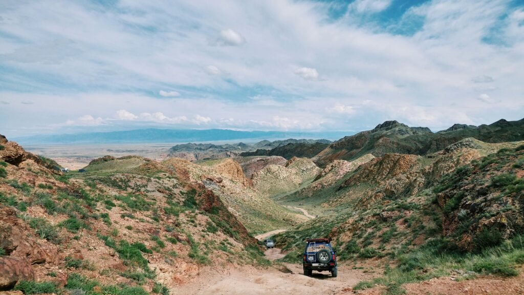
Mobile coverage can disappear quickly after leaving northern Nevada’s highways and communities. A campsite that appears close to Winnemucca, Elko, Ely or another town on a map may still be separated from reliable service by mountains, deep valleys and many miles of unpaved road.
When a phone cannot connect, navigation, weather updates and emergency communication may all stop working at once. Safe Northern Nevada camping requires making important decisions while service is still available.
The goal is not simply to download a map. Campers need a route, check-in procedure, emergency communication method and enough supplies to manage an unexpected delay.
Assume Service Will Be Unavailable
A coverage map is an estimate, not a promise that a phone will work at the campsite. Terrain, weather, distance from a tower and the mobile carrier can all affect reception.
Another camper having service does not mean every phone will connect. Their device may use a different network or have a clearer line to a tower.
Before leaving the last community, complete every task that normally requires an internet connection:
- Download maps
- Check weather and fire restrictions
- Save emergency numbers
- Send the trip plan
- Confirm the route
- Obtain permits when required
- Fill fuel and water containers
- Tell contacts when to expect the next update
Do not postpone these steps until the final highway turnout. Service may already be unreliable there.
“Emergency Calls Only” Is Not a Complete Plan
A phone may occasionally reach another carrier for an emergency call even when it cannot access normal service. That possibility should be treated as a backup, not the primary emergency plan.
A call may fail because:
- No compatible network is reachable
- Terrain blocks the signal
- The battery is depleted
- The phone was damaged
- The caller cannot identify the location
- Weather affects communication
- The nearest tower is overloaded or unavailable
Text-to-911 availability also varies. Do not assume a text will reach emergency services from a location where ordinary messages cannot be sent.
If a call connects, provide location information before giving a long explanation. The connection could be lost.
Create a Detailed Trip Plan
A useful trip plan contains enough information for another person to recognize that something has gone wrong and direct authorities toward the correct area.
Include:
- Names of every traveler
- Vehicle make, model, color and license plate
- Primary destination
- Planned campsite coordinates
- Driving route
- Trail or road names
- Intended activities
- Departure date
- Expected return time
- Planned check-in times
- Satellite-device information
- Medical or mobility concerns
- Contact information for the appropriate land manager
Leave the plan with someone dependable who will notice a missed check-in. Posting a general destination on social media is not a substitute.
“Camping somewhere north of Elko” is too broad. Provide coordinates and the exact approach road whenever possible.
Establish a Missed Check-In Procedure
The person holding the trip plan needs clear instructions about what to do if the camper does not report back.
Agree on:
- The exact check-in deadline
- A reasonable grace period
- Which numbers to call
- Whether the camper may change locations
- How satellite messages will appear
- Who has access to vehicle information
- When to contact emergency authorities
Do not choose a deadline so tight that a minor delay creates an unnecessary search. Do not make it so loose that an injured camper could remain missing for days.
If plans change, send the updated route before leaving service. A search based on the original location may send responders in the wrong direction.
Download More Than One Map
An online navigation app may stop loading when mobile service disappears. Download the relevant region for offline use before the trip.
One map may show roads without explaining land ownership or current closures. Another may show topography but omit the road name used by the land-management agency.
Carry information that covers:
- The highway approach
- Unpaved access roads
- Land ownership
- Topography
- Alternate exit routes
- Nearby water features
- Administrative boundaries
- Coordinates
A paper map provides an important backup if the phone fails. Mark the campsite, vehicle location and exit route before beginning an activity away from camp.
The Bureau of Land Management notes that many public-land destinations are remote and may lack amenities, mobile service and nearby emergency assistance. Check the appropriate BLM Nevada office for current maps and local restrictions.
Know How to Read Coordinates
Coordinates are more useful than a campsite nickname during an emergency. However, different devices may display them in different formats.
Confirm whether the coordinates are shown as:
- Decimal degrees
- Degrees and decimal minutes
- Degrees, minutes and seconds
Do not read numbers to a dispatcher without identifying the format. A formatting mistake can describe a location far from the actual emergency.
Save the campsite and vehicle coordinates in the phone, write them on paper and make sure more than one person knows where to find them.
If the group hikes away from camp, record the trailhead or departure point separately.
Consider a Satellite Communication Device
A satellite messenger or personal locator beacon can provide an additional way to request help beyond mobile coverage. These devices have different capabilities.
Some may offer:
- Emergency SOS
- Two-way text messaging
- Location sharing
- Weather information
- Preset check-in messages
A personal locator beacon may primarily transmit an emergency distress signal rather than provide normal two-way conversation.
Before the trip:
- Activate the device.
- Confirm the subscription.
- Register required information.
- Install updates.
- Test it according to the manufacturer’s instructions.
- Learn how to send an SOS.
- Show another group member how it works.
- Carry backup power.
- Understand how messages are delivered.
Do not purchase or borrow a device immediately before departure without learning to operate it. Emergency equipment is useful only when the group understands its limits.
Satellite Devices Still Have Limitations
Satellite communication generally works best with a clear view of the sky. Deep canyons, dense tree cover, buildings and terrain may delay or block a connection.
Messages may take time to transmit. Keep the device positioned as directed and watch for confirmation rather than assuming the message was sent.
An SOS button should be reserved for genuine emergencies. Once activated, remain available for follow-up questions when two-way communication is supported.
The device does not guarantee immediate rescue. Northern Nevada search-and-rescue teams may need significant time to reach a remote location, especially during darkness, bad weather or difficult road conditions.
The group must still be prepared to provide first aid, shelter and water while waiting.
Protect Phone Battery Life
A phone remains useful without service. It can store maps, coordinates, photographs, medical information and notes.
Extend battery life by:
- Using airplane mode when appropriate
- Reducing screen brightness
- Closing unnecessary applications
- Keeping the phone protected from extreme temperatures
- Carrying a charged power bank
- Using a vehicle charger
- Limiting entertainment use
- Keeping one group phone in reserve
Cold weather can reduce battery performance. Store electronics inside insulated gear rather than leaving them exposed overnight.
Heat can also damage phones and batteries. Do not leave them on a vehicle dashboard or in direct summer sun.
Charging equipment should be tested before leaving home. A cable that does not fit the device provides no value at a remote campsite.
Fuel Planning Begins Before the Dirt Road
A map showing 20 miles from the highway to camp does not mean the vehicle will use only the fuel expected for 20 miles of paved travel.
Unpaved routes may require:
- Low-speed driving
- Repeated acceleration
- Four-wheel drive
- Detours
- Idling
- Backtracking
- Travel around washouts
- Additional distance while locating the campsite
Fill the tank before entering the remote area and retain enough fuel to return to a reliable station. Do not plan to leave camp with the gauge near empty.
If carrying additional fuel, use an approved container and follow applicable safety requirements. Never carry gasoline inside the passenger compartment.
Vehicle Condition Becomes More Important
A minor vehicle problem in town can become an overnight emergency on a remote road.
Inspect:
- Tires
- Spare tire
- Jack and wheel tools
- Battery
- Belts and hoses
- Coolant
- Engine oil
- Lights
- Windshield
- Recovery points
- Fuel level
Know whether the vehicle has a locking wheel nut and where the key is stored. Practice locating the jack points before the trip.
Some northern Nevada roads contain sharp rock capable of damaging more than one tire. Consider the route and obtain local information about whether one spare is adequate.
Do not drive a two-wheel-drive or low-clearance vehicle into terrain simply because another vehicle left tire tracks.
Avoid Depending on Roadside Assistance
A roadside-assistance plan may cover towing, but that does not mean a tow truck will travel every unmaintained road.
The company may need:
- A reachable phone
- Accurate coordinates
- A passable route
- Permission to enter the land
- A vehicle accessible with its equipment
- Payment for services outside the plan
Ask about remote-road limitations before the trip. Save the policy information offline.
Recovery from sand, mud or snow may be classified differently from an ordinary highway tow and could be expensive or unavailable.
Carry More Water Than the Planned Stay Requires
Northern Nevada’s dry conditions can increase water needs, while wind and cool temperatures may hide how much moisture a person is losing.
Do not assume that a mapped spring, creek or stock tank will contain usable water. It may be dry, inaccessible, contaminated or reserved for wildlife and livestock.
Bring sufficient water for:
- Drinking
- Cooking
- Basic hygiene
- Pets
- An unexpected extra day
- Vehicle or medical emergencies when appropriate
Store water in more than one container. One damaged container should not eliminate the entire supply.
Backcountry water should be treated using an appropriate method, but treatment cannot make every polluted or chemically contaminated source safe. Carrying water is more dependable than planning to find it.
Check Weather for the Complete Route
The campsite forecast may not reflect conditions on the mountain pass, dry lake or access road.
Review:
- Daytime highs
- Overnight lows
- Wind
- Thunderstorms
- Flash-flood potential
- Snow
- Red Flag Warnings
- Smoke
- Road conditions
Northern Nevada can experience large temperature changes between day and night. A warm afternoon does not guarantee a mild night.
Check Nevada 511 for highway and road information before leaving service. Conditions on unmaintained roads may not appear in the system, so contact the land manager when recent storms have occurred.
Rain Can Eliminate the Exit Route
A short storm can turn clay and playa surfaces into deep mud. Dry washes may begin flowing even when rain falls beyond the campsite.
Do not camp in a wash or other obvious drainage channel. If thunderstorms are possible, identify whether the access road crosses low areas that could flood.
A route driven successfully on arrival may be impassable at departure. Avoid entering when the forecast suggests the road surface or crossings could deteriorate.
Driving around a muddy section creates new tracks and may damage sensitive land. Turning around early is usually better than becoming stuck farther from pavement.
Verify Fire Restrictions Before Leaving Service
Fire rules can change during the camping season. A previous visitor’s photograph of a campfire does not prove that fires are currently allowed.
Check restrictions with the correct land manager shortly before departure. Determine whether rules affect:
- Wood fires
- Charcoal
- Portable stoves
- Smoking
- Vehicle parking on vegetation
- Fireworks
- Cutting or collecting wood
- Target shooting
Bring a cooking plan that does not depend on a campfire. Even when fires are permitted, wind may make lighting one unsafe.
Never leave a fire unattended, and make sure it is completely extinguished according to land-manager guidance.
Tell the Group What to Do if Separated
Every person should know the campsite location, vehicle location and check-in plan. Do not keep all navigation information on one person’s phone.
Before hiking:
- Agree on the route.
- Establish turnaround times.
- Set meeting points.
- Carry water and appropriate clothing.
- Confirm who has emergency communication.
- Decide what to do if someone becomes separated.
A lost person may worsen the situation by continuing to move without a plan. Discuss appropriate lost-person procedures before the activity begins.
Children should carry basic identification and know that wandering in search of camp can make them harder to find.
Do Not Hike to Find a Signal Without a Plan
Climbing a ridge may improve reception, but it can also move the person away from shelter, water and a known location.
Do not leave an injured person alone to search randomly for service. If someone must travel for help, record their intended route, departure time and destination.
Whenever possible, use the satellite communication plan or send a capable pair rather than one person. The correct decision depends on the emergency, terrain, weather and group resources.
If the vehicle is safely accessible, remaining with it often makes the group easier to locate.
Prepare for Medical Problems
Remote campers should carry a first-aid kit appropriate for their activities and know how to use it.
The group should discuss:
- Allergies
- Essential medications
- Mobility limitations
- Relevant medical conditions
- Emergency contacts
- Medication storage temperatures
- Who has first-aid training
Bring more essential medication than the exact planned duration when medically appropriate. An impassable road could delay the return.
A first-aid kit does not replace professional care. The emergency plan should identify how help will be requested and what the group can safely do while waiting.
Mark the Vehicle’s Location Before Hiking
A vehicle can be surprisingly difficult to see from a distance in open terrain, particularly when parked behind vegetation or a low ridge.
Save its coordinates and mark the point on the offline map. Note nearby terrain features and the direction of the road.
Do not rely only on retracing an informal path. Wind, darkness and similar-looking landscape can make the return route unclear.
Leave enough daylight to reach camp safely unless the group is equipped and experienced for nighttime navigation.
Recheck the Plan at the Last Service Point
Before losing coverage, stop and perform one final review:
- Has the route changed?
- Did the weather forecast worsen?
- Are fire restrictions current?
- Is every device charged?
- Was the trip plan delivered?
- Are fuel and water sufficient?
- Does the satellite device show an active account?
- Is the vehicle operating normally?
- Does the group know the return deadline?
Send a final message identifying the point at which service is being left. If the destination changes afterward, update the contact by satellite when possible.
When to Turn Around
Turn around while the vehicle and group still have sufficient resources if:
- The route does not match the map
- Weather is deteriorating
- The road exceeds the vehicle’s capability
- Fuel consumption is higher than planned
- A critical device fails
- Water has been lost or contaminated
- Someone becomes ill
- A closure or private-property boundary appears
- Arrival would occur too late to establish camp safely
Reaching the campsite is optional. Preserving a safe route home is not.
Northern Nevada camping without mobile service can offer quiet, dark skies and extraordinary isolation. That isolation also means a delayed return may go unnoticed unless someone knows where the group intended to be.
Offline maps, adequate supplies and a tested satellite device are helpful. The most important protection is a precise trip plan connected to a responsible person who knows when and how to request help.
Note: This article provides general outdoor-preparedness information and is not a substitute for professional medical, navigation or emergency advice. Conditions and land restrictions can change quickly. Contact the responsible land manager before traveling.